Effect of heavy rains caught on camera


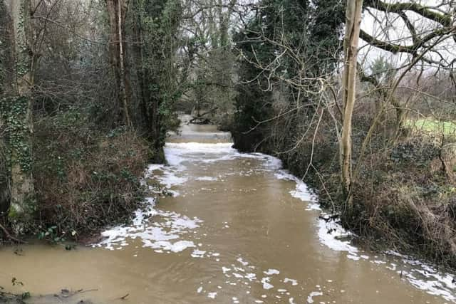
Reader Peter Merchant took images of the water levels on the River Arun on Sunday (December 31).
Peter was out walking at Chesworth Farm, south of Horsham when he spotted the high water levels on the river.
Advertisement
Hide AdAdvertisement
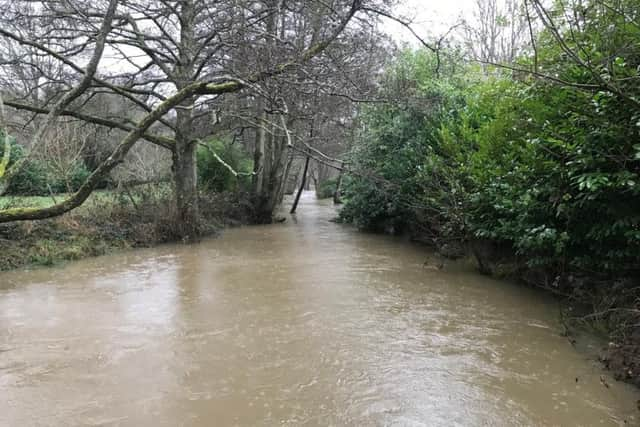
Hide AdBrian Burns took some images of the river at Pulborough on Monday.
The excess water has caused the river to burst its banks in places and flood adjoining fields.
Paul Michealwaite, of netweather.tv, explained why we are facing such unsettled weather and looked ahead to this weekend’s forecast.
He said: “The polar jet stream is a fast moving ribbon of air which flows around the planet, approx 11-17km above the surface.
Advertisement
Hide AdAdvertisement
Hide Ad“It marks the divide between arctic air and warmer mid-latitude air.
“At the moment it’s strong with wind speeds of around 200mph, thanks in part to the very cold weather in North America.
“It’s also nearby, so we’re bearing the brunt of some very unsettled weather.
“That lasts up to the end of the week, but it should move far enough away this weekend to settle things down for a while at least.
Advertisement
Hide AdAdvertisement
Hide Ad“At the same time though, some colder air will be back with us again.
“The weather has got off to a fast start in 2018, sending low after low our way during the first week, but a change is on the way this weekend.
“Saturday brings a change in wind direction, first into the north, then by Sunday the northeast.
“That’s a much colder direction, so feeling chill by day with frosts overnight, it should at least be drier though.”
Advertisement
Hide AdAdvertisement
Hide Ad“We’ve got the jet stream nearby at the moment, driving low pressure our way. When it dips a little south of us, often after a low has moved through, we get a colder blast, then it heads north again and we end up on the milder, wetter side of it again.” Forecast for this weekend:
Friday: Showers
High: 9c Low: 7c
Saturday: Cloudy
High: 5c Low: 2c
Sunday: Cloudy
High: 4c Low: 0c